Make a donation
Gear up for your next adventure:
As an Amazon Associate, this site earns from qualifying purchases at no extra cost to you.
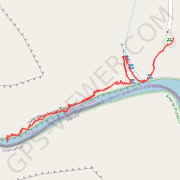
Santa Elena Canyon Trail in Big Bend National Park
The Santa Elena Canyon Trail offers a short but scenic hike through some of the most impressive landscapes in the park. After crossing Terlingua Creek and ascending some steps, hikers are greeted by stunning views of towering limestone cliffs that rise high above the Rio Grande. The trail’s peaceful vibe, combined with shaded spots by the river, makes it a lovely, refreshing escape, especially as the heat fades while you go deeper into the canyon. The short climb is worth the breathtaking panoramic views along the way. #Hiking #Canyon #River #Rock #Nature
- Distance: 1.8 mi
- Elevation gain: 136 m
- Maximum elevation: 759 m
- Elevation loss: 136 m
- Minimum elevation: 659 m
- Moving time: 57 m 5 s
- Moving speed: 1.9 mph
- Maximum speed: 3.5 mph
- Total time: 1 h 8 m
- Global speed: 1.6 mph
Interactive trail map
Make a donation
Gear up for your next adventure:
As an Amazon Associate, this site earns from qualifying purchases at no extra cost to you.
Trail profile
- Distance: 1.8 mi
- Elevation gain: 136 m
- Maximum elevation: 759 m
- Elevation loss: 136 m
- Minimum elevation: 659 m
- Moving time: 57 m 5 s
- Moving speed: 1.9 mph
- Maximum speed: 3.5 mph
- Total time: 1 h 8 m
- Global speed: 1.6 mph
Make a donation
Gear up for your next adventure:
As an Amazon Associate, this site earns from qualifying purchases at no extra cost to you.
About this trail
Name: Santa Elena Canyon Trail in Big Bend National Park trail, distance, elevation, map, profile, GPS track
Start: Santa Elena Canyon Trail, Brewster County, Texas, United States (29.16772 -103.61005)
End: Santa Elena Canyon Trail, Brewster County, Texas, United States (29.16746 -103.61032)
Coordinates: 29.16297 -103.61870 29.16772 -103.61004
Make a donation
Gear up for your next adventure:
As an Amazon Associate, this site earns from qualifying purchases at no extra cost to you.