Import a GPX file

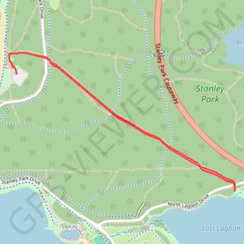
Stanley Park - Tatlow Walk - Lost Lagoon

#Hiking #Running #Stanley #Vancouver

  • Distance: 1.9 mi
  • Elevation gain: 81 m
  • Maximum elevation: 49 m
  • Elevation loss: 81 m
  • Minimum elevation: 4 m

Interactive trail map

Trail profile

  • Distance: 1.9 mi
  • Elevation gain: 81 m
  • Maximum elevation: 49 m
  • Elevation loss: 81 m
  • Minimum elevation: 4 m

About this trail

Other hiking, mountain biking, running and outdoor activity trails

Click on a trail to view its statistics, map and profile.

Stanley Park Loop

Canada > British Columbia > Metro Vancouver Regional District > Vancouver

Stanley Park. Stanley Park Seawall, Lost Lagoon, Ferguson Point, Siwash Rock Viewpoint, Prospect Point Lighthouse, Brockton Point Lighthouse. #Hiking #Bike #Running #Loop #Stanley #Vancouver

Distance: 5.8 mi • Elevation gain: 171 m • Maximum elevation: 25 m

Vancouver - Stanley Park

Canada > British Columbia > Metro Vancouver Regional District > Vancouver

#Hiking #Loop #Stanley #Vancouver

Distance: 9.3 mi • Elevation gain: 227 m • Maximum elevation: 43 m

Stanley Park Loop

Canada > British Columbia > Metro Vancouver Regional District > Vancouver

#Hiking #Running #Loop #Stanley #Park #Forest #Sea #Vancouver

Distance: 5.0 mi • Elevation gain: 144 m • Maximum elevation: 82 m

Gear up for your next adventure:

🧦Hiking Socks - Breathable socks designed to prevent blisters on long walks
🔋Rechargeable Batteries - Eco-friendly power for headlamps and older GPS units
🔋Lithium AA Batteries - Long-lasting power that performs well in cold mountain weather
📕Outdoor Navigation Books - Learn traditional and modern navigation techniques
🕶️Glacier Goggles - Maximum protection for high-altitude snow topography

As an Amazon Associate, this site earns from qualifying purchases at no extra cost to you.