Sleeping Beauty Mountain Provincial Park
#Hiking #MTB #SleepingBeautyMountain
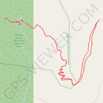
- Distance: 5.0 mi
- Elevation gain: 610 m
- Maximum elevation: 1,143 m
- Elevation loss: 610 m
- Minimum elevation: 532 m
Interactive trail map
Trail profile
- Distance: 5.0 mi
- Elevation gain: 610 m
- Maximum elevation: 1,143 m
- Elevation loss: 610 m
- Minimum elevation: 532 m
About this trail
Name: Sleeping Beauty Mountain Provincial Park trail, distance, elevation, map, profile, GPS track
Coordinates: 54.58033 -128.76763 54.59068 -128.74226