
2026_10_22_1513
- Distance: 7.1 mi
- Elevation gain: 300 m
- Maximum elevation: 239 m
- Elevation loss: 300 m
- Minimum elevation: 90 m
- Moving time: 2 h 45 m
- Moving speed: 2.6 mph
- Maximum speed: 20.2 mph
- Total time: 4 h 9 m
- Global speed: 1.7 mph
Interactive trail map
Trail profile
- Distance: 7.1 mi
- Elevation gain: 300 m
- Maximum elevation: 239 m
- Elevation loss: 300 m
- Minimum elevation: 90 m
- Moving time: 2 h 45 m
- Moving speed: 2.6 mph
- Maximum speed: 20.2 mph
- Total time: 4 h 9 m
- Global speed: 1.7 mph
About this trail
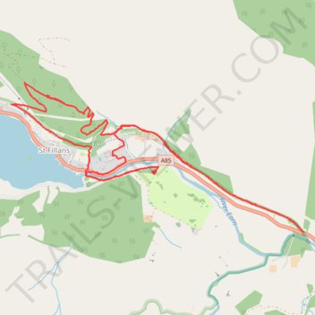
Name: 2026_10_22_1513 trail, distance, elevation, map, profile, GPS track
Coordinates: 56.38601 -4.12542 56.39817 -4.08266
Topography: Perth and Kinross topographic map, elevation, terrain
Other hiking, mountain biking, running and outdoor activity trails
Click on a trail to view its statistics, map and profile.

Loop Walk from St Fillans to Jerusalem in Glen Tarken
United Kingdom > Scotland > Perth and Kinross > St Fillans
Distance: 3.8 mi • Elevation gain: 198 m • Maximum elevation: 236 m
