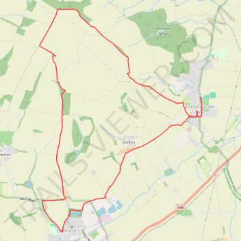
Ashton Under Hill
- Distance: 7.6 mi
- Elevation gain: 268 m
- Maximum elevation: 279 m
- Elevation loss: 275 m
- Minimum elevation: 34 m
Interactive trail map
Trail profile
- Distance: 7.6 mi
- Elevation gain: 268 m
- Maximum elevation: 279 m
- Elevation loss: 275 m
- Minimum elevation: 34 m
About this trail
Name: Ashton Under Hill trail, distance, elevation, map, profile, GPS track
Coordinates: 52.02012 -2.04413 52.05419 -2.00379
Topography: Wychavon topographic map, elevation, terrain
Other hiking, mountain biking, running and outdoor activity trails
Click on a trail to view its statistics, map and profile.
Elmley Castle
United Kingdom > England > Worcestershire > Wychavon > Elmley Castle
Distance: 8.8 mi • Elevation gain: 456 m • Maximum elevation: 300 m