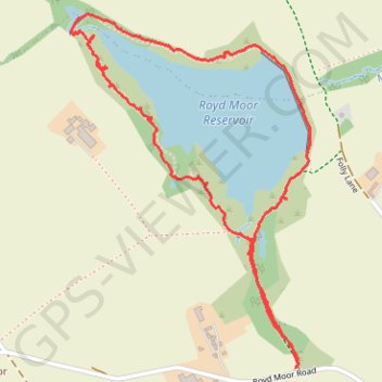
Royd Moor Reservoir (PBW)
Royd Moor Reservoir - Newt Pond
- Distance: 2.0 mi
- Elevation gain: 29 m
- Maximum elevation: 267 m
- Elevation loss: 29 m
- Minimum elevation: 247 m
- Moving time: 1 h 15 m
- Moving speed: 1.6 mph
- Maximum speed: 3.3 mph
- Total time: 1 h 57 m
- Global speed: 1.0 mph
Interactive trail map
Trail profile
- Distance: 2.0 mi
- Elevation gain: 29 m
- Maximum elevation: 267 m
- Elevation loss: 29 m
- Minimum elevation: 247 m
- Moving time: 1 h 15 m
- Moving speed: 1.6 mph
- Maximum speed: 3.3 mph
- Total time: 1 h 57 m
- Global speed: 1.0 mph
About this trail
Name: Royd Moor Reservoir (PBW) trail, distance, elevation, map, profile, GPS track
Coordinates: 53.53354 -1.67254 53.54223 -1.66267
Topography: England topographic map, elevation, terrain