Snow Gum Run Mount Baw Baw
- Distance: 9.4 mi
- Elevation gain: 465 m
- Maximum elevation: 1,554 m
- Elevation loss: 465 m
- Minimum elevation: 1,443 m
- Moving time: 2 h 26 m
- Moving speed: 3.8 mph
- Maximum speed: 8.4 mph
- Total time: 2 h 26 m
- Global speed: 3.8 mph
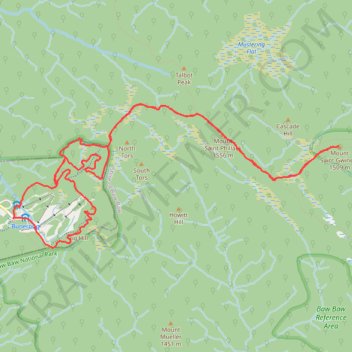
Interactive trail map
Trail profile
- Distance: 9.4 mi
- Elevation gain: 465 m
- Maximum elevation: 1,554 m
- Elevation loss: 465 m
- Minimum elevation: 1,443 m
- Moving time: 2 h 26 m
- Moving speed: 3.8 mph
- Maximum speed: 8.4 mph
- Total time: 2 h 26 m
- Global speed: 3.8 mph
About this trail
Name: Snow Gum Run Mount Baw Baw trail, distance, elevation, map, profile, GPS track
Coordinates: -37.84413 146.26455 -37.82778 146.31125
Other hiking, mountain biking, running and outdoor activity trails
Click on a trail to view its statistics, map and profile.
Traralgon - Walhalla - Woods Point
Australia > Victoria > Traralgon
#Bike
Distance: 77.4 mi • Elevation gain: 4,258 m • Maximum elevation: 1,165 m
Moe - Woods Point
#Bike
Distance: 67.8 mi • Elevation gain: 3,295 m • Maximum elevation: 1,165 m