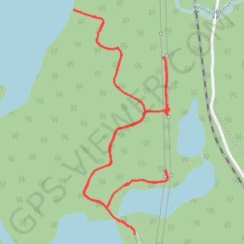
ATV riding at Anjigami
ATV, trail
- Distance: 3.0 mi
- Elevation gain: 71 m
- Maximum elevation: 302 m
- Elevation loss: 72 m
- Minimum elevation: 277 m
- Moving time: 20 m 54 s
- Moving speed: 8.6 mph
- Maximum speed: 15.1 mph
- Total time: 1 h 4 m
- Global speed: 2.8 mph
Interactive trail map
Trail profile
- Distance: 3.0 mi
- Elevation gain: 71 m
- Maximum elevation: 302 m
- Elevation loss: 72 m
- Minimum elevation: 277 m
- Moving time: 20 m 54 s
- Moving speed: 8.6 mph
- Maximum speed: 15.1 mph
- Total time: 1 h 4 m
- Global speed: 2.8 mph
About this trail
Name: ATV riding at Anjigami trail, distance, elevation, map, profile, GPS track
Coordinates: 47.90701 -84.54899 47.91658 -84.54295