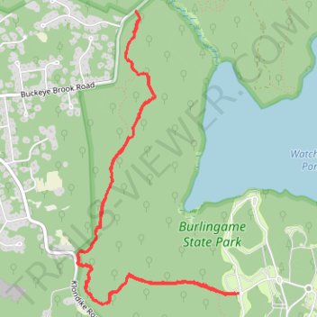
Vin Gormley Trail West Section
- Distance: 5.6 mi
- Elevation gain: 65 m
- Maximum elevation: 30 m
- Elevation loss: 65 m
- Minimum elevation: 17 m
- Moving time: 1 h 48 m
- Moving speed: 3.1 mph
- Maximum speed: 4.5 mph
- Total time: 2 h 54 m
- Global speed: 1.9 mph
Interactive trail map
Trail profile
- Distance: 5.6 mi
- Elevation gain: 65 m
- Maximum elevation: 30 m
- Elevation loss: 65 m
- Minimum elevation: 17 m
- Moving time: 1 h 48 m
- Moving speed: 3.1 mph
- Maximum speed: 4.5 mph
- Total time: 2 h 54 m
- Global speed: 1.9 mph
About this trail
Name: Vin Gormley Trail West Section trail, distance, elevation, map, profile, GPS track
Coordinates: 41.37295 -71.71585 41.39479 -71.69975
Other hiking, mountain biking, running and outdoor activity trails
Click on a trail to view its statistics, map and profile.
Burlingame State Park Loop
United States > Rhode Island > South County > Charlestown
Distance: 14.5 mi • Elevation gain: 224 m • Maximum elevation: 60 m