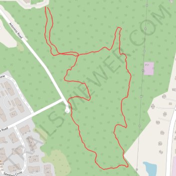
Antonino Woods hiking loop trail
- Distance: 1.3 mi
- Elevation gain: 24 m
- Maximum elevation: 41 m
- Elevation loss: 23 m
- Minimum elevation: 26 m
- Moving time: 33 m 30 s
- Moving speed: 2.3 mph
- Maximum speed: 3.6 mph
- Total time: 33 m 30 s
- Global speed: 2.3 mph
Interactive trail map
Trail profile
- Distance: 1.3 mi
- Elevation gain: 24 m
- Maximum elevation: 41 m
- Elevation loss: 23 m
- Minimum elevation: 26 m
- Moving time: 33 m 30 s
- Moving speed: 2.3 mph
- Maximum speed: 3.6 mph
- Total time: 33 m 30 s
- Global speed: 2.3 mph
About this trail
Name: Antonino Woods hiking loop trail trail, distance, elevation, map, profile, GPS track
Coordinates: 41.36538 -72.05125 41.37054 -72.04761