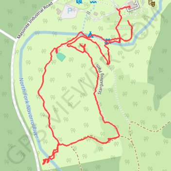
Camp Navarro hiking paths and POIs
- Distance: 1.7 mi
- Elevation gain: 77 m
- Maximum elevation: 66 m
- Elevation loss: 75 m
- Minimum elevation: 35 m
- Moving time: 43 m 58 s
- Moving speed: 2.3 mph
- Maximum speed: 4.3 mph
- Total time: 1 h 12 m
- Global speed: 1.4 mph
Interactive trail map
Trail profile
- Distance: 1.7 mi
- Elevation gain: 77 m
- Maximum elevation: 66 m
- Elevation loss: 75 m
- Minimum elevation: 35 m
- Moving time: 43 m 58 s
- Moving speed: 2.3 mph
- Maximum speed: 4.3 mph
- Total time: 1 h 12 m
- Global speed: 1.4 mph
About this trail
Name: Camp Navarro hiking paths and POIs trail, distance, elevation, map, profile, GPS track
Coordinates: 39.16451 -123.56909 39.17009 -123.56481