Great Victorian Rail Trail Alexandra to Yarck
- Distance: 26.8 mi
- Elevation gain: 431 m
- Maximum elevation: 288 m
- Elevation loss: 431 m
- Minimum elevation: 178 m
- Moving time: 2 h 32 m
- Moving speed: 10.5 mph
- Maximum speed: 19.2 mph
- Total time: 4 h 47 m
- Global speed: 5.6 mph
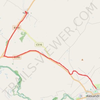
Interactive trail map
Trail profile
- Distance: 26.8 mi
- Elevation gain: 431 m
- Maximum elevation: 288 m
- Elevation loss: 431 m
- Minimum elevation: 178 m
- Moving time: 2 h 32 m
- Moving speed: 10.5 mph
- Maximum speed: 19.2 mph
- Total time: 4 h 47 m
- Global speed: 5.6 mph
About this trail
Name: Great Victorian Rail Trail Alexandra to Yarck trail, distance, elevation, map, profile, GPS track
End: Station Street, Alexandra, Shire of Murrindindi, Victoria, 3714, Australia (-37.18460 145.71375)
Coordinates: -37.18478 145.58646 -37.09942 145.71404
Other hiking, mountain biking, running and outdoor activity trails
Click on a trail to view its statistics, map and profile.
Alexandra - Cathkin - Molesworth
Australia > Victoria > Alexandra
#Bike
Distance: 12.2 mi • Elevation gain: 197 m • Maximum elevation: 288 m
Tallarook - Eildon - Hurstbridge
Australia > Victoria > Tallarook
#Bike
Distance: 173.2 mi • Elevation gain: 4,897 m • Maximum elevation: 868 m