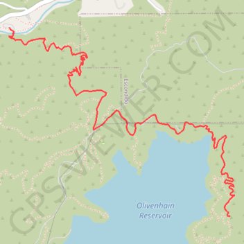
Lake Hodges Overlook
Interactive trail map
Trail profile
- Distance: 3.1 mi
- Elevation gain: 345 m
- Maximum elevation: 388 m
- Elevation loss: 128 m
- Minimum elevation: 154 m
About this trail
Name: Lake Hodges Overlook trail, distance, elevation, map, profile, GPS track
Start: Way Up Trail, San Diego County, California, 92029, United States (33.08658 -117.14527)
Coordinates: 33.07386 -117.14531 33.08658 -117.12715