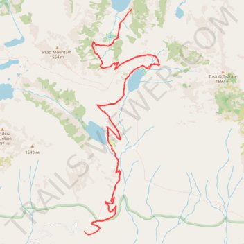
Talapus Lake Trailhead to Pratt Lake via Talapus Lake and Olallie Lake
- Distance: 11.1 mi
- Elevation gain: 769 m
- Maximum elevation: 1,262 m
- Elevation loss: 761 m
- Minimum elevation: 775 m
- Moving time: 5 h 25 m
- Moving speed: 2.0 mph
- Maximum speed: 10.2 mph
- Total time: 5 h 59 m
- Global speed: 1.8 mph
Interactive trail map
Trail profile
- Distance: 11.1 mi
- Elevation gain: 769 m
- Maximum elevation: 1,262 m
- Elevation loss: 761 m
- Minimum elevation: 775 m
- Moving time: 5 h 25 m
- Moving speed: 2.0 mph
- Maximum speed: 10.2 mph
- Total time: 5 h 59 m
- Global speed: 1.8 mph
About this trail
Name: Talapus Lake Trailhead to Pratt Lake via Talapus Lake and Olallie Lake trail, distance, elevation, map, profile, GPS track
Start: Forest Road 9030, King County, Washington, United States (47.40068 -121.52044)
End: Forest Road 9030, King County, Washington, United States (47.40113 -121.52110)
Coordinates: 47.40064 -121.52111 47.43264 -121.50533
Other hiking, mountain biking, running and outdoor activity trails
Click on a trail to view its statistics, map and profile.
Olallie and Talapus Lakes Trail in Mount Baker Snoqualmie National Forest
United States > Washington > King County
The Olallie and Talapus Lakes Trail in Mount Baker-Snoqualmie National Forest offers hikers a serene journey through lush forests, culminating in the tranquil waters of Talapus and Olallie Lakes. The well-maintained path winds through towering cedars and hemlocks, providing a cool, shaded canopy. Upon reaching…
Distance: 5.9 mi • Elevation gain: 421 m • Maximum elevation: 1,174 m
Northern part of the Pacific Crest Trail (PCT)
United States > Oregon > Klamath County
Hike on the Pacific Crest National Scenic Trail from Crater Lake to Canada Border through Oregon and Washington along the Sierra Nevada and Cascade mountain ranges. #Hiking #Mountain #SierraNevada #Cascade #Nature #Forest #Park #PCT
Distance: 744.6 mi • Elevation gain: 44,308 m • Maximum elevation: 2,307 m