White Butte
- Distance: 1.8 mi
- Elevation gain: 115 m
- Maximum elevation: 1,062 m
- Elevation loss: 115 m
- Minimum elevation: 961 m
- Moving time: 37 m 25 s
- Moving speed: 2.8 mph
- Maximum speed: 7.6 mph
- Total time: 44 m 42 s
- Global speed: 2.4 mph
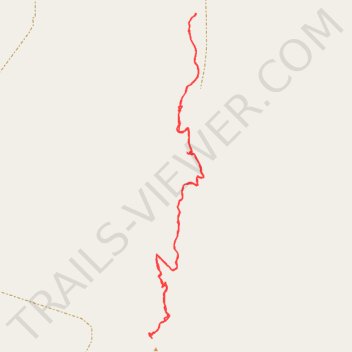
Interactive trail map
Trail profile
- Distance: 1.8 mi
- Elevation gain: 115 m
- Maximum elevation: 1,062 m
- Elevation loss: 115 m
- Minimum elevation: 961 m
- Moving time: 37 m 25 s
- Moving speed: 2.8 mph
- Maximum speed: 7.6 mph
- Total time: 44 m 42 s
- Global speed: 2.4 mph
About this trail
Name: White Butte trail, distance, elevation, map, profile, GPS track
Start: Slope County, North Dakota, United States (46.39571 -103.30083)
End: Slope County, North Dakota, United States (46.39570 -103.30081)
Coordinates: 46.38695 -103.30269 46.39571 -103.30052
Other hiking, mountain biking, running and outdoor activity trails
Click on a trail to view its statistics, map and profile.
White Butte Highpoint Trail
United States > North Dakota > Slope County
Hiking the White Butte Highpoint Trail offers a chance to experience the raw beauty of North Dakota's rugged badlands and rolling prairies. The trail takes you past the iconic white cliffs of the butte, leading to a summit with sweeping views of the surrounding farmland, distant rock formations, and on clear…
Distance: 1.6 mi • Elevation gain: 106 m • Maximum elevation: 1,063 m