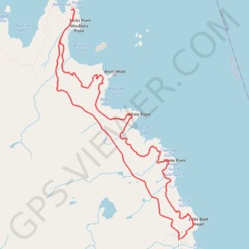
East Coast Trail - Biscane Cove Trail
#Hiking #Loop #Newfoundland #Atlantic
- Distance: 7.4 mi
- Elevation gain: 631 m
- Maximum elevation: 138 m
- Elevation loss: 632 m
- Minimum elevation: 15 m
Interactive trail map
Trail profile
- Distance: 7.4 mi
- Elevation gain: 631 m
- Maximum elevation: 138 m
- Elevation loss: 632 m
- Minimum elevation: 15 m
About this trail
Name: East Coast Trail - Biscane Cove Trail trail, distance, elevation, map, profile, GPS track
End: Main Road, Pouch Cove, Newfoundland, Newfoundland and Labrador, A0A 3L0, Canada (47.77546 -52.76452)
Coordinates: 47.77546 -52.79018 47.80770 -52.76160