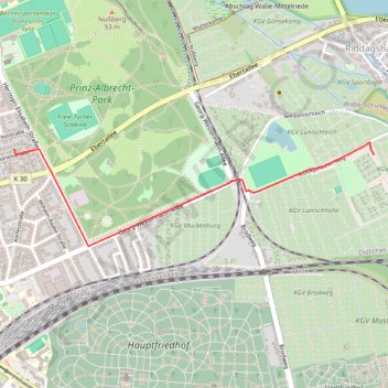
Riddagshäuser Weg, Georg-Westermann-Allee
- Distance: 1.3 mi
- Elevation gain: 12 m
- Maximum elevation: 84 m
- Elevation loss: 5 m
- Minimum elevation: 77 m
Interactive trail map
Trail profile
- Distance: 1.3 mi
- Elevation gain: 12 m
- Maximum elevation: 84 m
- Elevation loss: 5 m
- Minimum elevation: 77 m
About this trail
Name: Riddagshäuser Weg, Georg-Westermann-Allee trail, distance, elevation, map, profile, GPS track
Start: Riddagshäuser Weg, Östliches Ringgebiet, Brunswick, Lower Saxony, 38104, Germany (52.26488 10.57261)
End: 24, Marienstraße, Östliches Ringgebiet, Brunswick, Lower Saxony, 38104, Germany (52.26512 10.54933)
Coordinates: 52.26125 10.54933 52.26539 10.57261