Nottawasaga Bluffs Trail
Interactive trail map
Trail profile
- Distance: 5.8 mi
- Elevation gain: 136 m
- Maximum elevation: 529 m
- Elevation loss: 136 m
- Minimum elevation: 486 m
About this trail
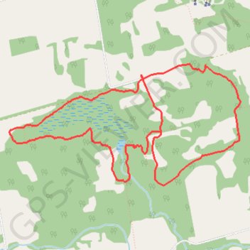
Name: Nottawasaga Bluffs Trail trail, distance, elevation, map, profile, GPS track
Coordinates: 44.33277 -80.22822 44.34420 -80.19784
Other hiking, mountain biking, running and outdoor activity trails
Click on a trail to view its statistics, map and profile.
Owen Sound - Orangeville
Canada > Ontario > Grey County > Owen Sound
Distance: 66.9 mi • Elevation gain: 593 m • Maximum elevation: 517 m
Keyhole Trail
Canada > Ontario > Simcoe County > Clearview
Distance: 3.5 mi • Elevation gain: 70 m • Maximum elevation: 515 m
Ontario country roads
Distance: 93.4 mi • Elevation gain: 1,137 m • Maximum elevation: 497 m