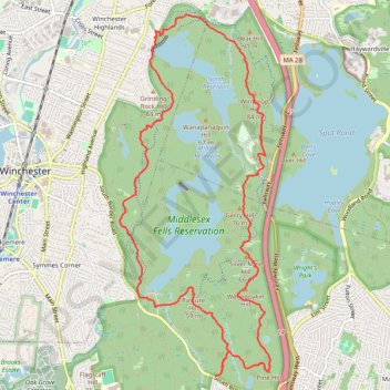
Skyline and Reservoir Loop Trail in Middlesex Fells Reservation
The Skyline and Reservoir Loop Trail offers a moderately challenging experience with rugged terrain, rewarding hikers with sweeping views of the Boston skyline. As the trail winds through forested sections and around scenic reservoirs, it also climbs to rocky summits, providing natural vantage points. This route combines a sense of peaceful remoteness with diverse landscapes, making it ideal for those seeking a scenic yet demanding hike close to the city. #Hiking #Loop #Lake #City #Forest #Nature
- Distance: 8.0 mi
- Elevation gain: 167 m
- Maximum elevation: 79 m
- Elevation loss: 166 m
- Minimum elevation: 38 m
- Moving time: 2 h 38 m
- Moving speed: 3.0 mph
- Maximum speed: 8.1 mph
- Total time: 2 h 39 m
- Global speed: 3.0 mph
Interactive trail map
Trail profile
- Distance: 8.0 mi
- Elevation gain: 167 m
- Maximum elevation: 79 m
- Elevation loss: 166 m
- Minimum elevation: 38 m
- Moving time: 2 h 38 m
- Moving speed: 3.0 mph
- Maximum speed: 8.1 mph
- Total time: 2 h 39 m
- Global speed: 3.0 mph
About this trail
Name: Skyline and Reservoir Loop Trail in Middlesex Fells Reservation trail, distance, elevation, map, profile, GPS track
Coordinates: 42.43232 -71.12451 42.46754 -71.10457
Other hiking, mountain biking, running and outdoor activity trails
Click on a trail to view its statistics, map and profile.
The Trails of Groton with 3k Dirt in Lincoln/Lexington (Arlington Start)
United States > Massachusetts > Middlesex County > Arlington
Distance: 69.2 mi • Elevation gain: 1,034 m • Maximum elevation: 109 m
2024 Bikes Not Bombs Bike-a-thon (BAT) Agony & Ecstasy
United States > Massachusetts > Suffolk County > Boston
Distance: 106.4 mi • Elevation gain: 1,714 m • Maximum elevation: 183 m
Nahant and Northern Strand Trail
United States > Massachusetts > Suffolk County > Boston
Distance: 43.7 mi • Elevation gain: 388 m • Maximum elevation: 23 m
BELLEVUE
United States > Massachusetts > Middlesex County > Medford
Bike Loop Bellevue
Distance: 7.0 mi • Elevation gain: 126 m • Maximum elevation: 88 m