Kooloon Park Loop
- Distance: 1.1 mi
- Elevation gain: 19 m
- Maximum elevation: 25 m
- Elevation loss: 13 m
- Minimum elevation: 16 m
Interactive trail map
Trail profile
- Distance: 1.1 mi
- Elevation gain: 19 m
- Maximum elevation: 25 m
- Elevation loss: 13 m
- Minimum elevation: 16 m
About this trail
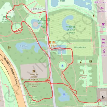
Name: Kooloon Park Loop trail, distance, elevation, map, profile, GPS track
Coordinates: 22.29852 114.16910 22.30100 114.17166
Other hiking, mountain biking, running and outdoor activity trails
Click on a trail to view its statistics, map and profile.
Wilson Trail Full Route
China > Hong Kong > Hong Kong Island
Distance: 50.5 mi • Elevation gain: 4,430 m • Maximum elevation: 613 m