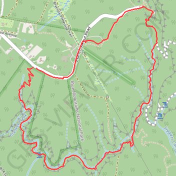
Import a GPX file

Grand Canyon Track

#Hiking #Loop

  • Distance: 3.7 mi
  • Elevation gain: 408 m
  • Maximum elevation: 999 m
  • Elevation loss: 408 m
  • Minimum elevation: 779 m

Interactive trail map

Trail profile

  • Distance: 3.7 mi
  • Elevation gain: 408 m
  • Maximum elevation: 999 m
  • Elevation loss: 408 m
  • Minimum elevation: 779 m

About this trail

Other hiking, mountain biking, running and outdoor activity trails

Click on a trail to view its statistics, map and profile.

Sydney - Katoomba

Australia > New South Wales > Sydney

#Bike #Loop

Distance: 137.3 mi • Elevation gain: 3,121 m • Maximum elevation: 1,026 m

Gear up for your next adventure:

🎒Multi-day Trekking Packs - Large capacity backpacks for wild camping and long-distance trails
🧼Camping Hygiene Kits - Compact hygiene essentials for outdoor stays
🧤Hiking Gloves - Warm and durable gloves for cold-weather walks
👖Convertible Hiking Trousers - Versatile zip-off pants for changing mountain weather conditions
📸Action Camera Chest Mounts - Record your ascent following topographic paths hands-free

As an Amazon Associate, this site earns from qualifying purchases at no extra cost to you.