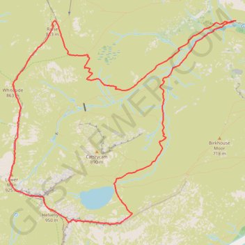
Hillwalk Helvellyn
Hillwalk, Helvellyn
- Distance: 7.1 mi
- Elevation gain: 787 m
- Maximum elevation: 942 m
- Elevation loss: 789 m
- Minimum elevation: 307 m
- Moving time: 3 h 20 m
- Moving speed: 2.1 mph
- Maximum speed: 3.8 mph
- Total time: 3 h 40 m
- Global speed: 1.9 mph
Interactive trail map
Trail profile
- Distance: 7.1 mi
- Elevation gain: 787 m
- Maximum elevation: 942 m
- Elevation loss: 789 m
- Minimum elevation: 307 m
- Moving time: 3 h 20 m
- Moving speed: 2.1 mph
- Maximum speed: 3.8 mph
- Total time: 3 h 40 m
- Global speed: 1.9 mph
About this trail
Name: Hillwalk Helvellyn trail, distance, elevation, map, profile, GPS track
Coordinates: 54.52538 -3.02572 54.54811 -2.98214
Topography: Westmorland and Furness topographic map, elevation, terrain