Import a GPX file

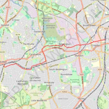
Sutton - East Croydon

Walk from Sutton to East Croydon via Beddington Park. #Walking #Hiking #City #Nature #Park

  • Distance: 5.8 mi
  • Elevation gain: 76 m
  • Maximum elevation: 78 m
  • Elevation loss: 76 m
  • Minimum elevation: 30 m
  • Moving time: 1 h 38 m
  • Moving speed: 3.6 mph
  • Maximum speed: 6.6 mph
  • Total time: 1 h 40 m
  • Global speed: 3.5 mph

Interactive trail map

Trail profile

  • Distance: 5.8 mi
  • Elevation gain: 76 m
  • Maximum elevation: 78 m
  • Elevation loss: 76 m
  • Minimum elevation: 30 m
  • Moving time: 1 h 38 m
  • Moving speed: 3.6 mph
  • Maximum speed: 6.6 mph
  • Total time: 1 h 40 m
  • Global speed: 3.5 mph

About this trail

Gear up for your next adventure:

👖Convertible Hiking Trousers - Versatile zip-off pants for changing mountain weather conditions
🧣Fleece Neck Warmers - Extra insulation for winter topographic surveys
🔋Lithium AA Batteries - Long-lasting power that performs well in cold mountain weather
🔦Outdoor Torches - Reliable torches for night navigation
🗺️Scratch-off Peak Maps - Track your progress climbing Munros or Wainwrights

As an Amazon Associate, this site earns from qualifying purchases at no extra cost to you.