Pike Lake Loop
Loop run / hike from Pike Lake Dam via Mitchell Ridge Trail, Valley Bridle Trail, Buckeye Trail and Wildcat Hollow Trail in the Pike Lake State Park and the Pike State Forest. #Running #Hiking #Loop #Lake #Forest #Mountain #Nature #Park
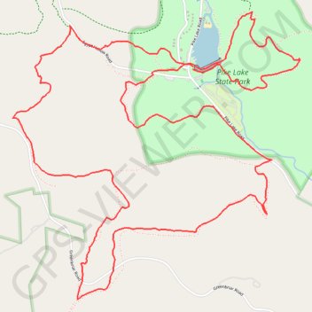
- Distance: 7.3 mi
- Elevation gain: 472 m
- Maximum elevation: 386 m
- Elevation loss: 472 m
- Minimum elevation: 226 m
- Moving time: 1 h 44 m
- Moving speed: 4.2 mph
- Maximum speed: 11.0 mph
- Total time: 1 h 45 m
- Global speed: 4.1 mph
Interactive trail map
Trail profile
- Distance: 7.3 mi
- Elevation gain: 472 m
- Maximum elevation: 386 m
- Elevation loss: 472 m
- Minimum elevation: 226 m
- Moving time: 1 h 44 m
- Moving speed: 4.2 mph
- Maximum speed: 11.0 mph
- Total time: 1 h 45 m
- Global speed: 4.1 mph
About this trail
Name: Pike Lake Loop trail, distance, elevation, map, profile, GPS track
Start: Shelter House, Pike Lake Road, Pike County, Ohio, 45612, United States (39.15904 -83.22104)
End: Buckeye Trail, Pike County, Ohio, United States (39.15920 -83.22098)
Coordinates: 39.14420 -83.23601 39.16273 -83.21214