Import a GPX file

Stirling

Walk from the city center to the castle. #Walking #City #Castle

  • Distance: 0.9 mi
  • Elevation gain: 68 m
  • Maximum elevation: 93 m
  • Elevation loss: 2 m
  • Minimum elevation: 25 m
  • Moving time: 28 m 23 s
  • Moving speed: 1.9 mph
  • Maximum speed: 5.5 mph
  • Total time: 43 m 3 s
  • Global speed: 1.2 mph

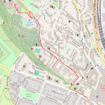
Interactive trail map

Trail profile

  • Distance: 0.9 mi
  • Elevation gain: 68 m
  • Maximum elevation: 93 m
  • Elevation loss: 2 m
  • Minimum elevation: 25 m
  • Moving time: 28 m 23 s
  • Moving speed: 1.9 mph
  • Maximum speed: 5.5 mph
  • Total time: 43 m 3 s
  • Global speed: 1.2 mph

About this trail

Gear up for your next adventure:

🩹Hiking First Aid Kits - Compact medical kits tailored for trail injuries and emergencies
📦Dry Bags - Waterproof bags to protect gear from rain
🚲Cycling GPS Computers - Track elevation and topographic routes on two wheels
🔋Rechargeable Batteries - Eco-friendly power for headlamps and older GPS units
🧢Hiking Hats - Sun and weather protection for outdoor walks

As an Amazon Associate, this site earns from qualifying purchases at no extra cost to you.