First time on Dream On, Salida, Colorado
- Distance: 16.6 mi
- Elevation gain: 564 m
- Maximum elevation: 2,299 m
- Elevation loss: 564 m
- Minimum elevation: 2,136 m
- Moving time: 1 h 54 m
- Moving speed: 8.7 mph
- Maximum speed: 23.4 mph
- Total time: 2 h 58 m
- Global speed: 5.6 mph
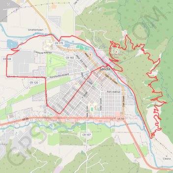
Interactive trail map
Trail profile
- Distance: 16.6 mi
- Elevation gain: 564 m
- Maximum elevation: 2,299 m
- Elevation loss: 564 m
- Minimum elevation: 2,136 m
- Moving time: 1 h 54 m
- Moving speed: 8.7 mph
- Maximum speed: 23.4 mph
- Total time: 2 h 58 m
- Global speed: 5.6 mph
About this trail
Name: First time on Dream On, Salida, Colorado trail, distance, elevation, map, profile, GPS track
Start: 601, West 16th Street, Salida, Chaffee County, Colorado, 81201, United States (38.52718 -106.01018)
End: 615, West 16th Street, Salida, Chaffee County, Colorado, 81201, United States (38.52724 -106.01043)
Coordinates: 38.51860 -106.02429 38.54622 -105.97003