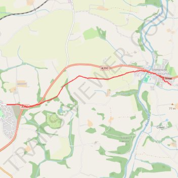
Probus Trewithen Grampound
- Distance: 2.5 mi
- Elevation gain: 47 m
- Maximum elevation: 101 m
- Elevation loss: 90 m
- Minimum elevation: 22 m
- Moving time: 30 m 42 s
- Moving speed: 4.9 mph
- Maximum speed: 7.4 mph
- Total time: 32 m 13 s
- Global speed: 4.6 mph
Interactive trail map
Trail profile
- Distance: 2.5 mi
- Elevation gain: 47 m
- Maximum elevation: 101 m
- Elevation loss: 90 m
- Minimum elevation: 22 m
- Moving time: 30 m 42 s
- Moving speed: 4.9 mph
- Maximum speed: 7.4 mph
- Total time: 32 m 13 s
- Global speed: 4.6 mph
About this trail
Name: Probus Trewithen Grampound trail, distance, elevation, map, profile, GPS track
Start: Probus, Cornwall, England, TR2 4PY, United Kingdom (50.29289 -4.94638)
Coordinates: 50.29240 -4.94638 50.29946 -4.89647
Topography: Cornwall topographic map, elevation, terrain
Other hiking, mountain biking, running and outdoor activity trails
Click on a trail to view its statistics, map and profile.