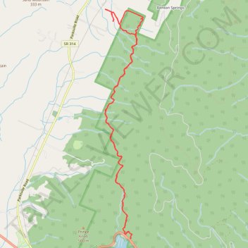
Prince Gap Trail
- Distance: 8.7 mi
- Elevation gain: 390 m
- Maximum elevation: 378 m
- Elevation loss: 388 m
- Minimum elevation: 270 m
- Moving time: 2 h 47 m
- Moving speed: 3.1 mph
- Maximum speed: 4.9 mph
- Total time: 4 h 48 s
- Global speed: 2.2 mph
Interactive trail map
Trail profile
- Distance: 8.7 mi
- Elevation gain: 390 m
- Maximum elevation: 378 m
- Elevation loss: 388 m
- Minimum elevation: 270 m
- Moving time: 2 h 47 m
- Moving speed: 3.1 mph
- Maximum speed: 4.9 mph
- Total time: 4 h 48 s
- Global speed: 2.2 mph
About this trail
Name: Prince Gap Trail trail, distance, elevation, map, profile, GPS track
Coordinates: 35.10383 -84.63611 35.14639 -84.62745