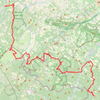
Andata
- Distance: 40.1 mi
- Elevation gain: 2,837 m
- Maximum elevation: 750 m
- Elevation loss: 2,436 m
- Minimum elevation: 167 m
Interactive trail map
Trail profile
- Distance: 40.1 mi
- Elevation gain: 2,837 m
- Maximum elevation: 750 m
- Elevation loss: 2,436 m
- Minimum elevation: 167 m
About this trail
Name: Andata trail, distance, elevation, map, profile, GPS track
Coordinates: 44.14560 11.40360 44.31555 11.63558
Other hiking, mountain biking, running and outdoor activity trails
Click on a trail to view its statistics, map and profile.
1 LUCENA - MONTPELLIER
Distance: 1,842.0 mi • Elevation gain: 29,500 m • Maximum elevation: 1,048 m