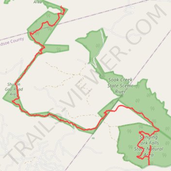
CT - Stinging Fork to Pond Cove Creek Campsite via CT - Hinch Mountain
- Distance: 11.6 mi
- Elevation gain: 650 m
- Maximum elevation: 764 m
- Elevation loss: 510 m
- Minimum elevation: 414 m
- Moving time: 4 h 47 m
- Moving speed: 2.4 mph
- Maximum speed: 4.5 mph
- Total time: 5 h 26 m
- Global speed: 2.1 mph
Interactive trail map
Trail profile
- Distance: 11.6 mi
- Elevation gain: 650 m
- Maximum elevation: 764 m
- Elevation loss: 510 m
- Minimum elevation: 414 m
- Moving time: 4 h 47 m
- Moving speed: 2.4 mph
- Maximum speed: 4.5 mph
- Total time: 5 h 26 m
- Global speed: 2.1 mph
About this trail
Name: CT - Stinging Fork to Pond Cove Creek Campsite via CT - Hinch Mountain trail, distance, elevation, map, profile, GPS track
Start: CT - Stinging Fork, Rhea County, East Tennessee, Tennessee, United States (35.71278 -84.92855)
Coordinates: 35.71273 -84.98532 35.76612 -84.92432
Other hiking, mountain biking, running and outdoor activity trails
Click on a trail to view its statistics, map and profile.
Cumberland Trail from Head of Sequatchie to Stinging Fork via Hinch Mountain
United States > Tennessee > Cumberland County
Distance: 17.5 mi • Elevation gain: 1,110 m • Maximum elevation: 765 m
CT - Upper and Lower Piney River
United States > Tennessee > Rhea County
Distance: 12.8 mi • Elevation gain: 505 m • Maximum elevation: 547 m