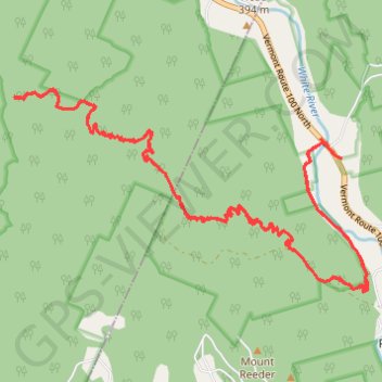
Tunnel Ridge in Green Mountain National Forest
- Distance: 17.1 mi
- Elevation gain: 1,023 m
- Maximum elevation: 769 m
- Elevation loss: 1,022 m
- Minimum elevation: 257 m
- Moving time: 3 h 27 m
- Moving speed: 4.9 mph
- Maximum speed: 21.4 mph
- Total time: 4 h 44 m
- Global speed: 3.6 mph
Interactive trail map
Trail profile
- Distance: 17.1 mi
- Elevation gain: 1,023 m
- Maximum elevation: 769 m
- Elevation loss: 1,022 m
- Minimum elevation: 257 m
- Moving time: 3 h 27 m
- Moving speed: 4.9 mph
- Maximum speed: 21.4 mph
- Total time: 4 h 44 m
- Global speed: 3.6 mph
About this trail
Name: Tunnel Ridge in Green Mountain National Forest trail, distance, elevation, map, profile, GPS track
Start: 91, Ranger Road, Rochester, Windsor County, Vermont, 05767, United States (43.89608 -72.81943)
End: Ranger Road, Rochester, Windsor County, Vermont, 05767, United States (43.89599 -72.81879)
Coordinates: 43.88050 -72.87115 43.90394 -72.81460
Other hiking, mountain biking, running and outdoor activity trails
Click on a trail to view its statistics, map and profile.