Import a GPX file

Arrastre Creek

Hike on the Pacific Crest Trail (PCT) along the Arrastre Creek in the San Bernardino National Forest. #Hiking #River #Nature #Forest #PCT

  • Distance: 3.8 mi
  • Elevation gain: 55 m
  • Maximum elevation: 2,460 m
  • Elevation loss: 394 m
  • Minimum elevation: 2,103 m

Interactive trail map

Trail profile

  • Distance: 3.8 mi
  • Elevation gain: 55 m
  • Maximum elevation: 2,460 m
  • Elevation loss: 394 m
  • Minimum elevation: 2,103 m

About this trail

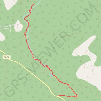
Name: Arrastre Creek trail, distance, elevation, map, profile, GPS track

Start: Broom Flats Road, San Bernardino County, California, United States (34.20739 -116.73789)

End: Pacific Crest National Scenic Trail #2000, San Bernardino County, California, United States (34.23827 -116.74742)

Coordinates: 34.20705 -116.75163 34.23827 -116.73010

Gear up for your next adventure:

🔪Outdoor Multi-Tools - Versatile tools for gear repairs and food prep in the wild
🧦Merino Wool Hiking Socks - Moisture-wicking socks to prevent blisters during long mountain walks
🧴Tick Removal Tools - Small, essential health tool for UK woodland and moorland
🧢Thermal Beanie Hats - Prevent heat loss from the head in windy summit conditions
🎒Backpack Rain Covers - Universal waterproof covers to protect your gear from downpours

As an Amazon Associate, this site earns from qualifying purchases at no extra cost to you.