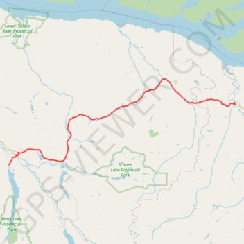
Import a GPX file

Sayward - Woss Lake

Vancouver Island. #Bike #Vancouver

  • Distance: 43.7 mi
  • Elevation gain: 937 m
  • Maximum elevation: 440 m
  • Elevation loss: 800 m
  • Minimum elevation: 21 m

Interactive trail map

Trail profile

  • Distance: 43.7 mi
  • Elevation gain: 937 m
  • Maximum elevation: 440 m
  • Elevation loss: 800 m
  • Minimum elevation: 21 m

About this trail

Gear up for your next adventure:

🧢Waterproof Hiking Hats - Keep the rain off your face while studying topographic maps
🧺Ultralight Dry Bags - Organize and waterproof your gear inside your rucksack
🎒Hiking Child Carriers - Explore the outdoors with the whole family safely
📷Outdoor Action Cameras - Cameras designed for hiking and adventure
Camping Shelters - Emergency and lightweight shelters for outdoor use

As an Amazon Associate, this site earns from qualifying purchases at no extra cost to you.