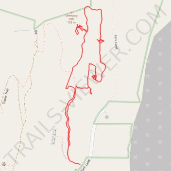
Orenaug Park
- Distance: 1.1 mi
- Elevation gain: 43 m
- Maximum elevation: 154 m
- Elevation loss: 54 m
- Minimum elevation: 121 m
- Moving time: 29 m 26 s
- Moving speed: 2.2 mph
- Maximum speed: 5.4 mph
- Total time: 1 h 23 m
- Global speed: 0.8 mph
Interactive trail map
Trail profile
- Distance: 1.1 mi
- Elevation gain: 43 m
- Maximum elevation: 154 m
- Elevation loss: 54 m
- Minimum elevation: 121 m
- Moving time: 29 m 26 s
- Moving speed: 2.2 mph
- Maximum speed: 5.4 mph
- Total time: 1 h 23 m
- Global speed: 0.8 mph
About this trail
Name: Orenaug Park trail, distance, elevation, map, profile, GPS track
Coordinates: 41.53973 -73.20201 41.54415 -73.20050