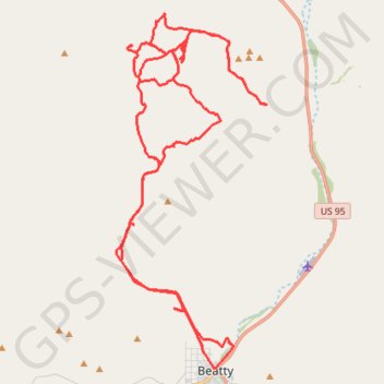
Beatty
- Distance: 39.9 mi
- Elevation gain: 1,555 m
- Maximum elevation: 1,357 m
- Elevation loss: 1,291 m
- Minimum elevation: 1,009 m
- Moving time: 3 h 36 m
- Moving speed: 11.1 mph
- Maximum speed: 42.1 mph
- Total time: 5 h 59 m
- Global speed: 6.7 mph
Interactive trail map
Trail profile
- Distance: 39.9 mi
- Elevation gain: 1,555 m
- Maximum elevation: 1,357 m
- Elevation loss: 1,291 m
- Minimum elevation: 1,009 m
- Moving time: 3 h 36 m
- Moving speed: 11.1 mph
- Maximum speed: 42.1 mph
- Total time: 5 h 59 m
- Global speed: 6.7 mph
About this trail
Name: Beatty trail, distance, elevation, map, profile, GPS track
Start: 1383, North B Avenue, Beatty, Nye County, Nevada, 89003, United States (36.91348 -116.76377)
End: Beatty, Nye County, Nevada, 89003, United States (36.97474 -116.77437)
Coordinates: 36.90853 -116.79609 37.01423 -116.73971