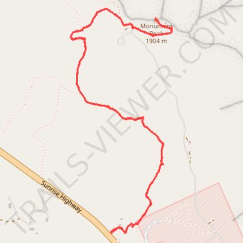
Monument Peak via Pacific Crest National Scenic Trail (PCT)
- Distance: 3.8 mi
- Elevation gain: 196 m
- Maximum elevation: 1,901 m
- Elevation loss: 196 m
- Minimum elevation: 1,766 m
- Moving time: 1 h 54 m
- Moving speed: 2.0 mph
- Maximum speed: 3.1 mph
- Total time: 2 h 43 m
- Global speed: 1.4 mph
Interactive trail map
Trail profile
- Distance: 3.8 mi
- Elevation gain: 196 m
- Maximum elevation: 1,901 m
- Elevation loss: 196 m
- Minimum elevation: 1,766 m
- Moving time: 1 h 54 m
- Moving speed: 2.0 mph
- Maximum speed: 3.1 mph
- Total time: 2 h 43 m
- Global speed: 1.4 mph
About this trail
Name: Monument Peak via Pacific Crest National Scenic Trail (PCT) trail, distance, elevation, map, profile, GPS track
Start: Piedra Tract, San Diego County, California, 91948, United States (32.88012 -116.42369)
End: Piedra Tract, San Diego County, California, 91948, United States (32.88002 -116.42366)
Coordinates: 32.87998 -116.42648 32.89299 -116.41949
Other hiking, mountain biking, running and outdoor activity trails
Click on a trail to view its statistics, map and profile.
Epic Big Laguna Route
United States > California > San Diego County
Distance: 9.2 mi • Elevation gain: 342 m • Maximum elevation: 1,891 m