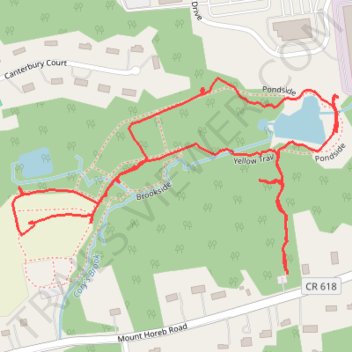
George Dealaman Nature Park loop trails
- Distance: 1.7 mi
- Elevation gain: 17 m
- Maximum elevation: 138 m
- Elevation loss: 16 m
- Minimum elevation: 125 m
- Moving time: 44 m 2 s
- Moving speed: 2.3 mph
- Maximum speed: 7.5 mph
- Total time: 54 m 43 s
- Global speed: 1.9 mph
Interactive trail map
Trail profile
- Distance: 1.7 mi
- Elevation gain: 17 m
- Maximum elevation: 138 m
- Elevation loss: 16 m
- Minimum elevation: 125 m
- Moving time: 44 m 2 s
- Moving speed: 2.3 mph
- Maximum speed: 7.5 mph
- Total time: 54 m 43 s
- Global speed: 1.9 mph
About this trail
Name: George Dealaman Nature Park loop trails trail, distance, elevation, map, profile, GPS track
Coordinates: 40.62573 -74.51301 40.62937 -74.50507