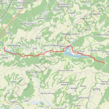
Import a GPX file

TRK000

  • Distance: 21.8 mi
  • Elevation gain: 221 m
  • Maximum elevation: 111 m
  • Elevation loss: 221 m
  • Minimum elevation: 62 m

Interactive trail map

Trail profile

  • Distance: 21.8 mi
  • Elevation gain: 221 m
  • Maximum elevation: 111 m
  • Elevation loss: 221 m
  • Minimum elevation: 62 m

About this trail

Gear up for your next adventure:

🌄Outdoor Binoculars - Compact binoculars for landscape observation
👟Men's Trail Running Shoes - Lightweight grip for fast movement over topographic contours
👖Hiking Trousers - Durable trousers designed for rough terrain
🧴Sport Sunscreen Sticks - High-protection sunblock that won't run into your eyes on the trail
📍Handheld GPS Navigators - Reliable satellite navigation for hiking and off-road exploration

As an Amazon Associate, this site earns from qualifying purchases at no extra cost to you.