Tewantin National Park Loop
Interactive trail map
Trail profile
- Distance: 5.4 mi
- Elevation gain: 166 m
- Maximum elevation: 139 m
- Elevation loss: 166 m
- Minimum elevation: 18 m
About this trail
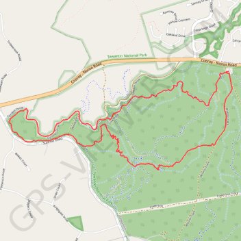
Name: Tewantin National Park Loop trail, distance, elevation, map, profile, GPS track
Start: Wooroi Day Use Area, Indy, Tewantin, Noosa Shire, Queensland, 4565, Australia (-26.39997 153.00938)
End: Wooroi Day Use Area, Hovea, Tewantin, Noosa Shire, Queensland, 4565, Australia (-26.39997 153.00938)
Coordinates: -26.41025 152.98368 -26.39997 153.00978
Other hiking, mountain biking, running and outdoor activity trails
Click on a trail to view its statistics, map and profile.
Tinbeerwah - Tewantin National Park - Ringtail State Forest
Australia > Queensland > Tewantin
#MTB #Loop #Tinbeerwah #Tewantin #Ringtail
Distance: 30.3 mi • Elevation gain: 707 m • Maximum elevation: 219 m
Loop on Mount Tinbeerwah in Tewantin National Park
Australia > Queensland > Tewantin
Distance: 10.8 mi • Elevation gain: 329 m • Maximum elevation: 211 m
Imbil Jimna Kenilworth loop
Australia > Queensland > Tewantin
Distance: 134.2 mi • Elevation gain: 3,884 m • Maximum elevation: 822 m
Yurol State Forest Loop
Australia > Queensland > Cooroy
Distance: 28.0 mi • Elevation gain: 610 m • Maximum elevation: 145 m
Mount Tinbeerwah ride in Tewantin National Park
Australia > Queensland > Tewantin
Distance: 14.3 mi • Elevation gain: 449 m • Maximum elevation: 140 m
Kandanga Wrattens Widgee Loop
Australia > Queensland > Tewantin
Distance: 136.9 mi • Elevation gain: 3,584 m • Maximum elevation: 684 m
Noosa Enduro MTB Course
Australia > Queensland > Tewantin
Distance: 56.9 mi • Elevation gain: 1,691 m • Maximum elevation: 460 m