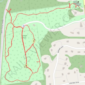
Koegel Park loop
- Distance: 2.4 mi
- Elevation gain: 81 m
- Maximum elevation: 203 m
- Elevation loss: 86 m
- Minimum elevation: 169 m
- Moving time: 49 m 33 s
- Moving speed: 2.9 mph
- Maximum speed: 5.2 mph
- Total time: 53 m 28 s
- Global speed: 2.7 mph
Interactive trail map
Trail profile
- Distance: 2.4 mi
- Elevation gain: 81 m
- Maximum elevation: 203 m
- Elevation loss: 86 m
- Minimum elevation: 169 m
- Moving time: 49 m 33 s
- Moving speed: 2.9 mph
- Maximum speed: 5.2 mph
- Total time: 53 m 28 s
- Global speed: 2.7 mph
About this trail
Name: Koegel Park loop trail, distance, elevation, map, profile, GPS track
Coordinates: 41.32560 -73.75762 41.33085 -73.75095
Other hiking, mountain biking, running and outdoor activity trails
Click on a trail to view its statistics, map and profile.