Import a GPX file

Hidden Falls Loop

Hidden Falls Regional Park. Deadman Creek. #Hiking #Loop #Waterfall #River #Forest #Nature

  • Distance: 3.3 mi
  • Elevation gain: 182 m
  • Maximum elevation: 306 m
  • Elevation loss: 182 m
  • Minimum elevation: 167 m

Interactive trail map

Trail profile

  • Distance: 3.3 mi
  • Elevation gain: 182 m
  • Maximum elevation: 306 m
  • Elevation loss: 182 m
  • Minimum elevation: 167 m

About this trail

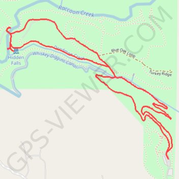
Name: Hidden Falls Loop trail, distance, elevation, map, profile, GPS track

Start: Hidden Gateway, Placer County, California, United States (38.95855 -121.16390)

End: Hidden Gateway, Placer County, California, United States (38.95855 -121.16390)

Coordinates: 38.95855 -121.17847 38.96838 -121.16356

Gear up for your next adventure:

🖼️Topographic Map Art - Decorative 3D-effect posters of famous UK peaks and regions
📐Altimeters & Barometers - Tools for measuring altitude and air pressure
🛰️Outdoor GPS Navigation - Navigation devices for remote and off-grid areas
📦Dry Bags - Waterproof bags to protect gear from rain
🦟Anti-Midge & Tick Repellent - Vital for hiking in the Scottish Highlands during summer

As an Amazon Associate, this site earns from qualifying purchases at no extra cost to you.