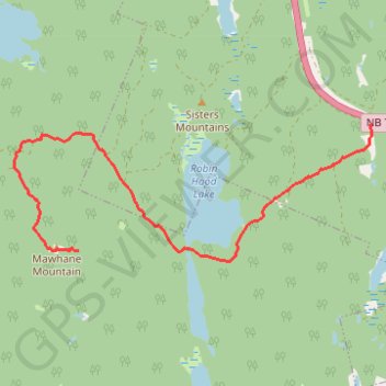
Mawhane Mountain
Robin Hood Lake. #Hiking
- Distance: 10.3 mi
- Elevation gain: 340 m
- Maximum elevation: 225 m
- Elevation loss: 340 m
- Minimum elevation: 59 m
Interactive trail map
Trail profile
- Distance: 10.3 mi
- Elevation gain: 340 m
- Maximum elevation: 225 m
- Elevation loss: 340 m
- Minimum elevation: 59 m
About this trail
Name: Mawhane Mountain trail, distance, elevation, map, profile, GPS track
Coordinates: 45.34952 -66.33737 45.36501 -66.28004
Other hiking, mountain biking, running and outdoor activity trails
Click on a trail to view its statistics, map and profile.
Upper Kingsclear - Carters Point
Canada > New Brunswick > Kingsclear Parish
Saint John River. #Bike
Distance: 77.8 mi • Elevation gain: 1,030 m • Maximum elevation: 121 m