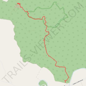
Mount Kandanga via Ryan's Creek Road
- Distance: 5.1 mi
- Elevation gain: 528 m
- Maximum elevation: 554 m
- Elevation loss: 115 m
- Minimum elevation: 113 m
- Moving time: 22 m 59 s
- Moving speed: 13.3 mph
- Maximum speed: 36.2 mph
- Total time: 44 m 28 s
- Global speed: 6.9 mph
Interactive trail map
Trail profile
- Distance: 5.1 mi
- Elevation gain: 528 m
- Maximum elevation: 554 m
- Elevation loss: 115 m
- Minimum elevation: 113 m
- Moving time: 22 m 59 s
- Moving speed: 13.3 mph
- Maximum speed: 36.2 mph
- Total time: 44 m 28 s
- Global speed: 6.9 mph
About this trail
Name: Mount Kandanga via Ryan's Creek Road trail, distance, elevation, map, profile, GPS track
End: Ryan's Creek Road, Imbil, Gympie Regional, Queensland, 4570, Australia (-26.44801 152.57628)
Coordinates: -26.48875 152.57475 -26.44711 152.60476
Other hiking, mountain biking, running and outdoor activity trails
Click on a trail to view its statistics, map and profile.
Imbil Jimna Kenilworth loop
Australia > Queensland > Tewantin
Distance: 134.2 mi • Elevation gain: 3,884 m • Maximum elevation: 822 m
Kandanga Wrattens Widgee Loop
Australia > Queensland > Tewantin
Distance: 136.9 mi • Elevation gain: 3,584 m • Maximum elevation: 684 m