Canyon Country Park loop walk
- Distance: 1.6 mi
- Elevation gain: 53 m
- Maximum elevation: 489 m
- Elevation loss: 53 m
- Minimum elevation: 452 m
- Moving time: 36 m 35 s
- Moving speed: 2.6 mph
- Maximum speed: 4.3 mph
- Total time: 43 m 3 s
- Global speed: 2.2 mph
Interactive trail map
Trail profile
- Distance: 1.6 mi
- Elevation gain: 53 m
- Maximum elevation: 489 m
- Elevation loss: 53 m
- Minimum elevation: 452 m
- Moving time: 36 m 35 s
- Moving speed: 2.6 mph
- Maximum speed: 4.3 mph
- Total time: 43 m 3 s
- Global speed: 2.2 mph
About this trail
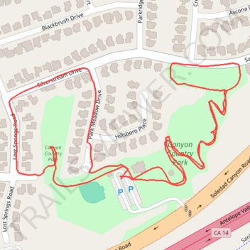
Name: Canyon Country Park loop walk trail, distance, elevation, map, profile, GPS track
Coordinates: 34.41838 -118.44449 34.42057 -118.43952