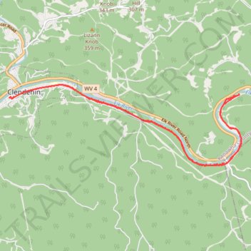
Elk River Trail Clendenin Section
- Distance: 12.1 mi
- Elevation gain: 505 m
- Maximum elevation: 214 m
- Elevation loss: 505 m
- Minimum elevation: 185 m
- Moving time: 1 h 14 m
- Moving speed: 9.7 mph
- Maximum speed: 19.5 mph
- Total time: 1 h 14 m
- Global speed: 9.7 mph
Interactive trail map
Trail profile
- Distance: 12.1 mi
- Elevation gain: 505 m
- Maximum elevation: 214 m
- Elevation loss: 505 m
- Minimum elevation: 185 m
- Moving time: 1 h 14 m
- Moving speed: 9.7 mph
- Maximum speed: 19.5 mph
- Total time: 1 h 14 m
- Global speed: 9.7 mph
About this trail
Name: Elk River Trail Clendenin Section trail, distance, elevation, map, profile, GPS track
Coordinates: 38.47010 -81.35274 38.49044 -81.27862