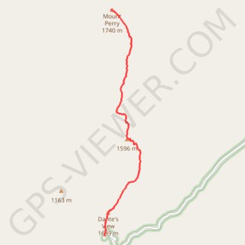
Import a GPX file

Mount Perry

Hike from the Dante's View to the Mount Perry along Dante's Ridge in the Death Valley National Park. #Hiking #Mountain #Nature #Desert #Park

  • Distance: 4.5 mi
  • Elevation gain: 380 m
  • Maximum elevation: 1,745 m
  • Elevation loss: 313 m
  • Minimum elevation: 1,508 m

Interactive trail map

Trail profile

  • Distance: 4.5 mi
  • Elevation gain: 380 m
  • Maximum elevation: 1,745 m
  • Elevation loss: 313 m
  • Minimum elevation: 1,508 m

About this trail

Name: Mount Perry trail, distance, elevation, map, profile, GPS track

Start: Dante's View Parking, Dantes View Road, Inyo County, California, United States (36.22090 -116.72650)

End: Inyo County, California, United States (36.27377 -116.72457)

Coordinates: 36.22090 -116.72651 36.27377 -116.71614

Gear up for your next adventure:

📸Action Camera Chest Mounts - Record your ascent following topographic paths hands-free
🧴Sport Sunscreen Sticks - High-protection sunblock that won't run into your eyes on the trail
🎒Hiking Child Carriers - Explore the outdoors with the whole family safely
❄️Walking Crampons - Added traction for icy slopes and winter peak bagging
🧥Softshell Jackets - Breathable jackets for active outdoor use

As an Amazon Associate, this site earns from qualifying purchases at no extra cost to you.