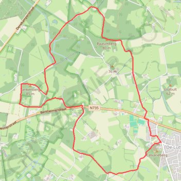
Tankenberg 2015
- Distance: 5.9 mi
- Elevation gain: 105 m
- Maximum elevation: 85 m
- Elevation loss: 104 m
- Minimum elevation: 47 m
Interactive trail map
Trail profile
- Distance: 5.9 mi
- Elevation gain: 105 m
- Maximum elevation: 85 m
- Elevation loss: 104 m
- Minimum elevation: 47 m
About this trail
Name: Tankenberg 2015 trail, distance, elevation, map, profile, GPS track
Start: Plechelmusstraat, de Lutte, Losser, Overijssel, Netherlands, 7587 AM, Netherlands (52.31505 6.98714)
End: Plechelmusstraat, de Lutte, Losser, Overijssel, Netherlands, 7587 AM, Netherlands (52.31507 6.98723)
Coordinates: 52.31035 6.95299 52.33507 6.98723