Import a GPX file

Warembourg Open Space fishing pond loop

  • Distance: 1.0 mi
  • Elevation gain: 14 m
  • Maximum elevation: 1,657 m
  • Elevation loss: 12 m
  • Minimum elevation: 1,642 m
  • Moving time: 17 m 35 s
  • Moving speed: 3.6 mph
  • Maximum speed: 4.0 mph
  • Total time: 17 m 35 s
  • Global speed: 3.6 mph

Interactive trail map

Trail profile

  • Distance: 1.0 mi
  • Elevation gain: 14 m
  • Maximum elevation: 1,657 m
  • Elevation loss: 12 m
  • Minimum elevation: 1,642 m
  • Moving time: 17 m 35 s
  • Moving speed: 3.6 mph
  • Maximum speed: 4.0 mph
  • Total time: 17 m 35 s
  • Global speed: 3.6 mph

About this trail

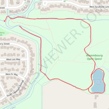
Name: Warembourg Open Space fishing pond loop trail, distance, elevation, map, profile, GPS track

Start: 536, West Sycamore Circle, Louisville, Boulder County, Colorado, 80027, United States (39.97205 -105.14817)

End: 542, West Sycamore Circle, Louisville, Boulder County, Colorado, 80027, United States (39.97230 -105.14903)

Coordinates: 39.96914 -105.14903 39.97248 -105.14332

Gear up for your next adventure:

🎿Telescopic Trekking Poles - Reduces knee strain on steep topographic descents
🐕Dog Hiking Gear - Equipment for hiking safely with dogs
🗺️Topographic Maps - Detailed maps showing elevation and terrain features
🕶️Polarized Sunglasses - Reduces glare from snow and water when reading terrain
🧼Biodegradable Soap - Leave-no-trace hygiene for multi-day mountain treks

As an Amazon Associate, this site earns from qualifying purchases at no extra cost to you.