The real Manson Cave
- Distance: 1.0 mi
- Elevation gain: 84 m
- Maximum elevation: 456 m
- Elevation loss: 118 m
- Minimum elevation: 350 m
- Moving time: 32 m 5 s
- Moving speed: 1.8 mph
- Maximum speed: 3.7 mph
- Total time: 1 h 45 m
- Global speed: 0.6 mph
Interactive trail map
Trail profile
- Distance: 1.0 mi
- Elevation gain: 84 m
- Maximum elevation: 456 m
- Elevation loss: 118 m
- Minimum elevation: 350 m
- Moving time: 32 m 5 s
- Moving speed: 1.8 mph
- Maximum speed: 3.7 mph
- Total time: 1 h 45 m
- Global speed: 0.6 mph
About this trail
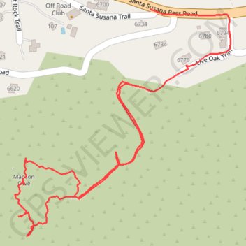
Name: The real Manson Cave trail, distance, elevation, map, profile, GPS track
Coordinates: 34.25623 -118.66056 34.25981 -118.65645