Radočelo Studenica - Krivača - Brezna - Studenica
- Distance: 15.3 mi
- Elevation gain: 1,322 m
- Maximum elevation: 1,622 m
- Elevation loss: 1,324 m
- Minimum elevation: 473 m
- Moving time: 7 h 18 m
- Moving speed: 2.1 mph
- Maximum speed: 32.4 mph
- Total time: 8 h 19 m
- Global speed: 1.8 mph
Interactive trail map
Trail profile
- Distance: 15.3 mi
- Elevation gain: 1,322 m
- Maximum elevation: 1,622 m
- Elevation loss: 1,324 m
- Minimum elevation: 473 m
- Moving time: 7 h 18 m
- Moving speed: 2.1 mph
- Maximum speed: 32.4 mph
- Total time: 8 h 19 m
- Global speed: 1.8 mph
About this trail
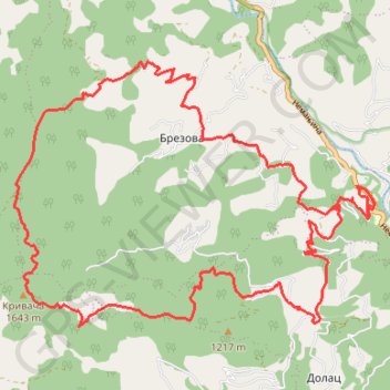
Name: Radočelo Studenica - Krivača - Brezna - Studenica trail, distance, elevation, map, profile, GPS track
Coordinates: 43.47015 20.47191 43.50316 20.53343
Other hiking, mountain biking, running and outdoor activity trails
Click on a trail to view its statistics, map and profile.
Golija: selo Rudno - Radočelo (vrh Krivača)
Serbia > Central Serbia > Raska Administrative District > Rudno
Distance: 12.9 mi • Elevation gain: 776 m • Maximum elevation: 1,630 m
2022_Yu
Slovenia > Ajdovščina > Žapuže
Distance: 1,526.9 mi • Elevation gain: 32,048 m • Maximum elevation: 1,950 m